Oslo Harbor Promenade: Venice Beach the Oslo Way!

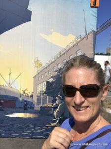
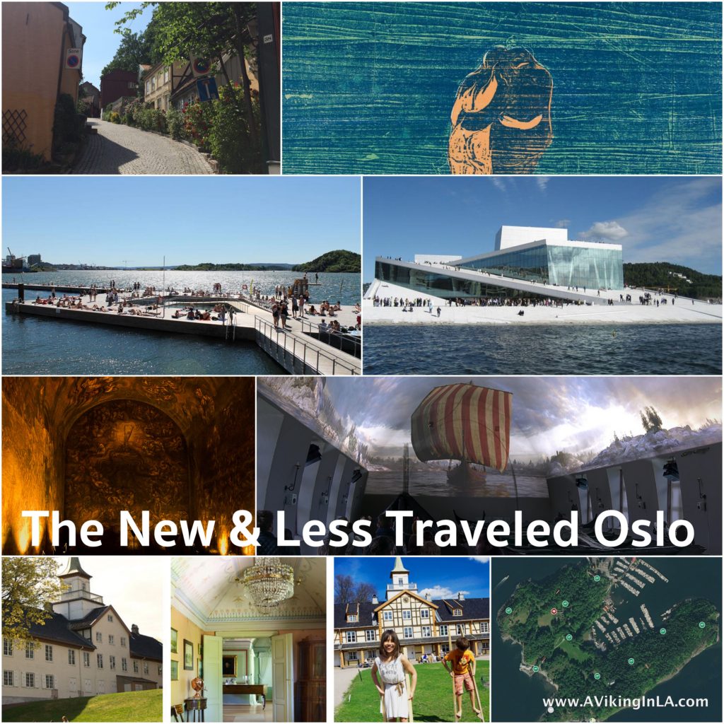
During our one and only full day in Oslo this summer, we explored one of the city’s newer attractions, the Harbor Promenade, known as Havnepromenaden in Norwegian. It’s a walking/biking path that stretches nine kilometers (about 5.5 miles) along Oslo’s waterfront and combines sightseeing, history, art, architecture, shopping, dining, and a little bit of adventure. Large orange information towers guide the way. (And there are plenty of geocaching opportunities along the way for those who are interested as well.)

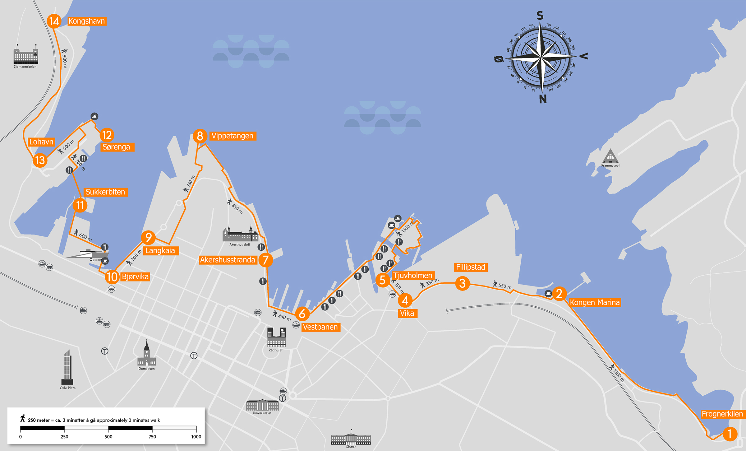
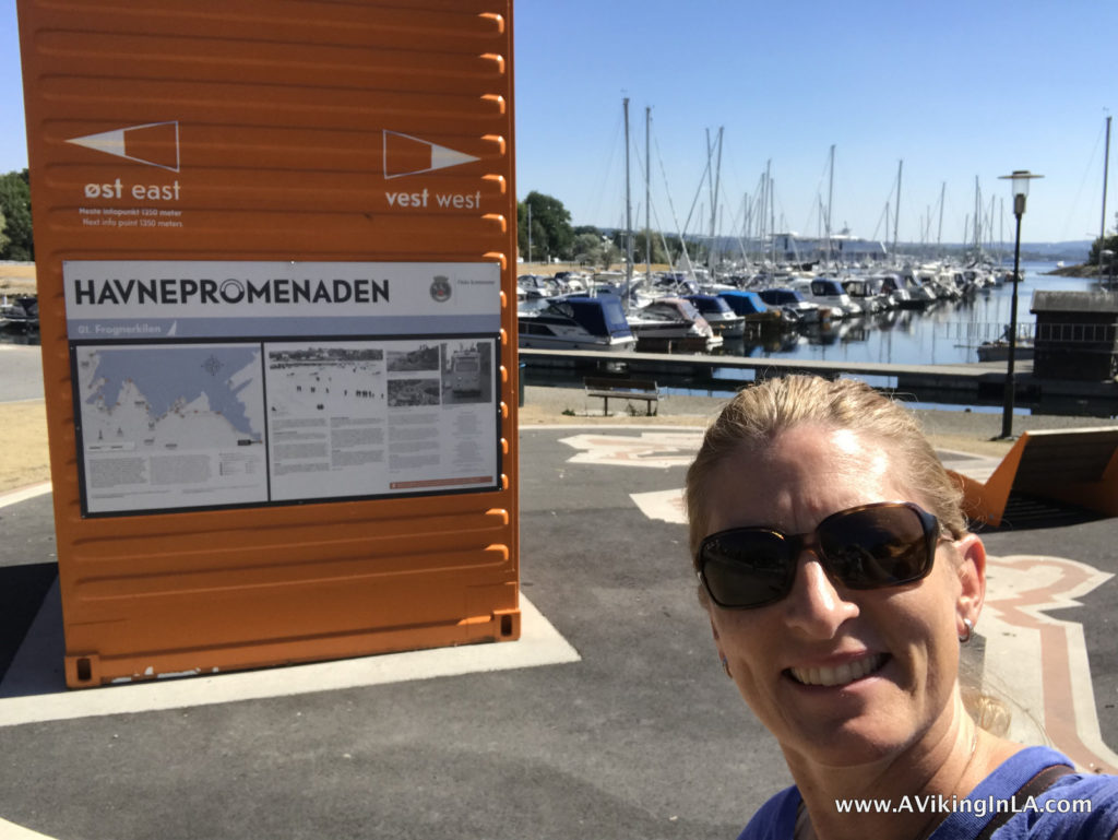
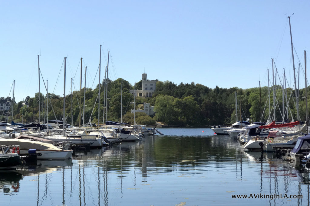
Our adventure began at Frognerkilen (Point #1 on the map). We were greeted by the peaceful sight of docked boats and wandering ducks and geese. The first stretch of the promenade was a pleasant and leisurely walk right along the shoreline.

We enjoyed watching boats coming and going and swans searching for food. In the distance, we saw the ferry bound for Denmark leave port. On the other side of the inlet on the Bygdøy peninsula, we spotted Oscarshall, the royal summer palace completed in 1852 and open to the public since 1881.

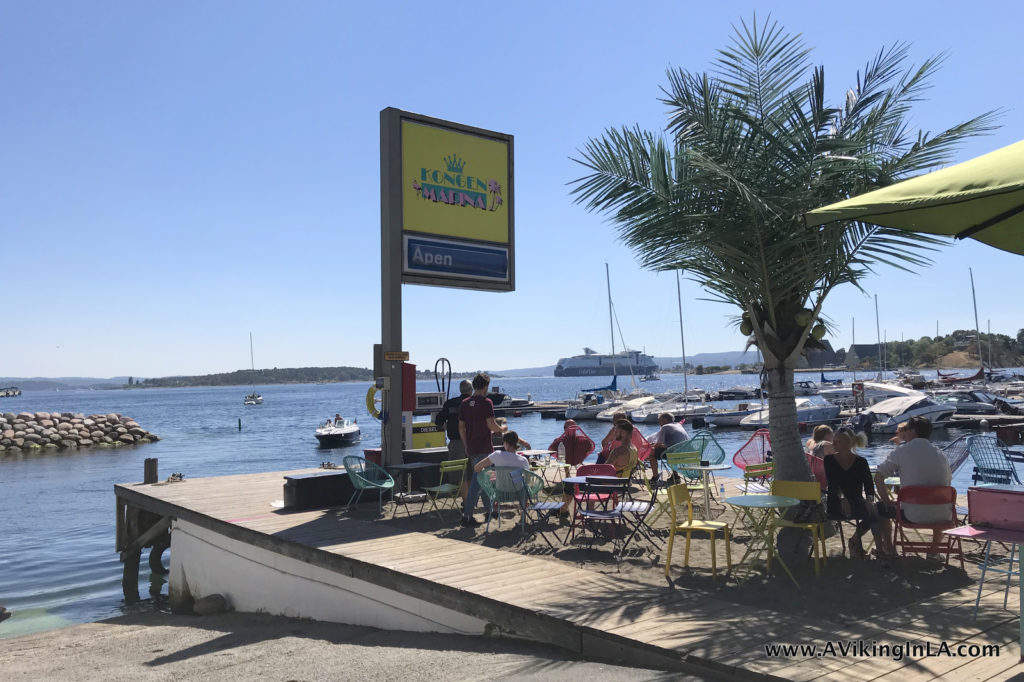
At Kongen Marina (Point #2), a tropical themed café awaited. It was a very welcoming and enticing place, but we had plans to eat lunch later on in our outing. It was too popular for me to search for the geocache that was there. Reluctantly, we continued on.

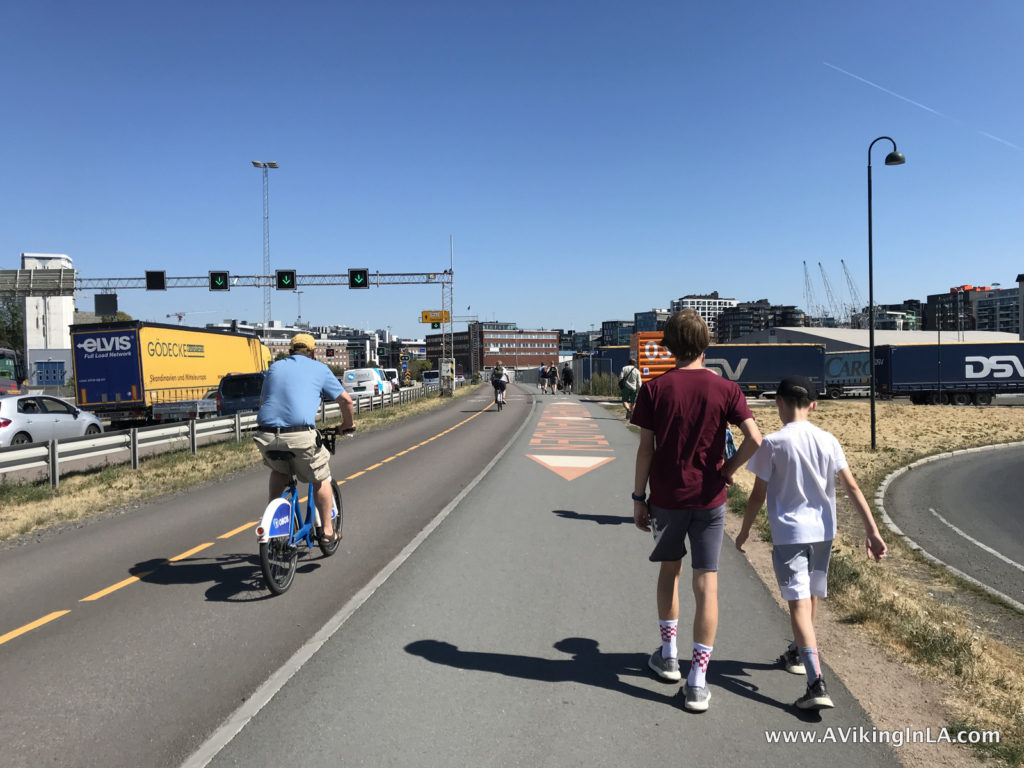
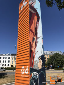
The next stretch of the promenade, through Filipstad, was not as appealing. The path was right next to the motorway with only industrial buildings in sight. The comic book artwork on the orange towers did provide some fun diversion along the way, though. Also, at Point #3, I was able to easily retrieve a geocache since there were no people lingering.


There are plans underway to develop this area into an attractive residential community which will make a huge difference!

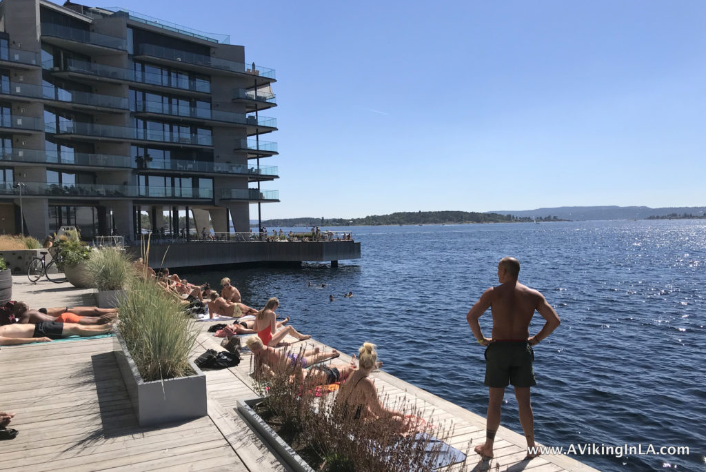
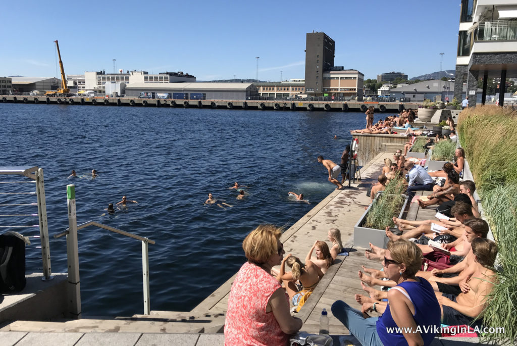
Luckily, this uninteresting stretch didn’t last too long and soon we were at Tjuvholmen which was a stark contrast to what we’d just encountered. We were suddenly surrounded by a chic, happening waterfront with bright and bold artwork, modern architecture, and an active folk life. I could have just stayed there and people watched for hours. Any thoughts of more geocaching were quickly forgotten.

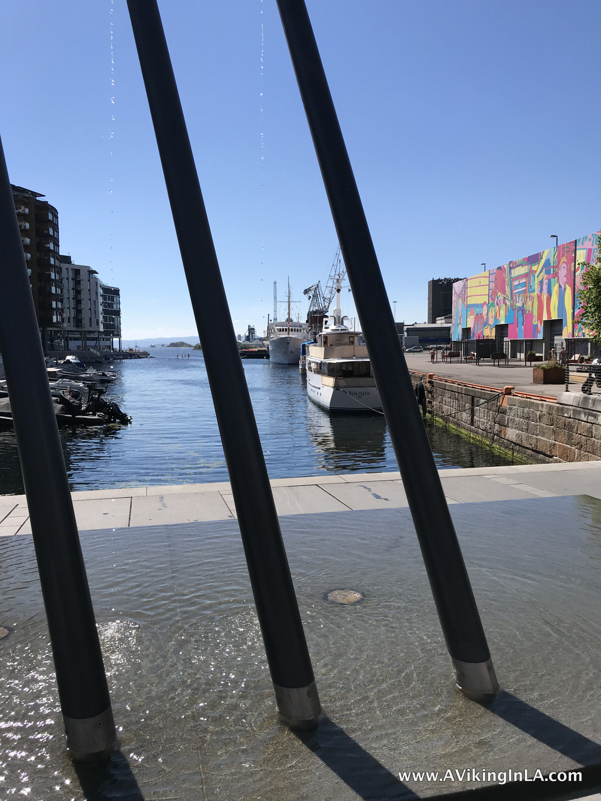
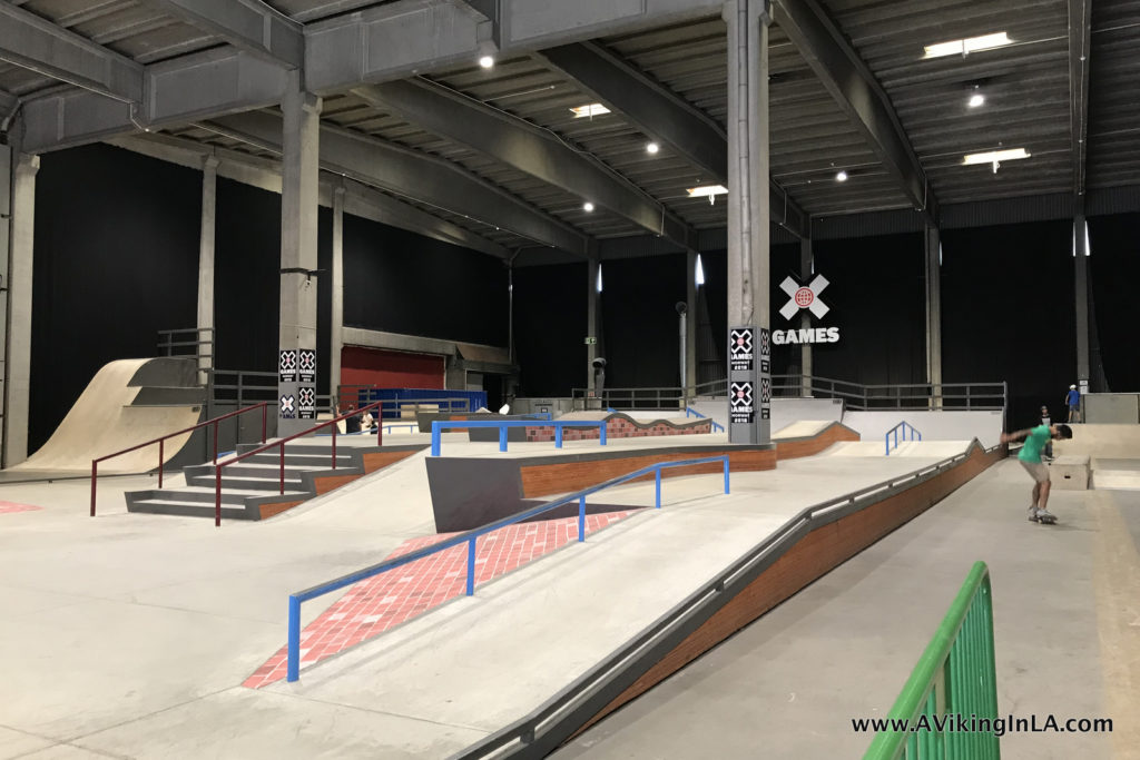
We chuckled at how the area reminded us of Los Angeles’ Venice Beach! We already had the palms in mind from Kongen Marina. Now we saw huge wall murals (art by Norwegian pop artist Pushwagner, 1940-2018), an outdoor workout area (complete with bare chested men and bikini clad women!), a skatepark (though indoors and practically empty because, as you’ll see, everyone is outside swimming!), stand-up paddle boarding, sunning, and swimming.

I was mesmerized by all the people swimming and hanging out by the edge of the fjord. Oslo has been unseasonably warm and dry this summer and people were taking advantage. And this wasn’t even a weekend day. It was a Monday.

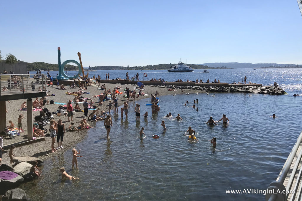
In addition to alluring outdoor spaces and fascinating architecture, Tjuvholmen is home to the modern art museum Astrup Fearnley Museet and an outdoor sculpture park. We lost sight of that with all the swimming going on, but they were there right next to the sandy beach.

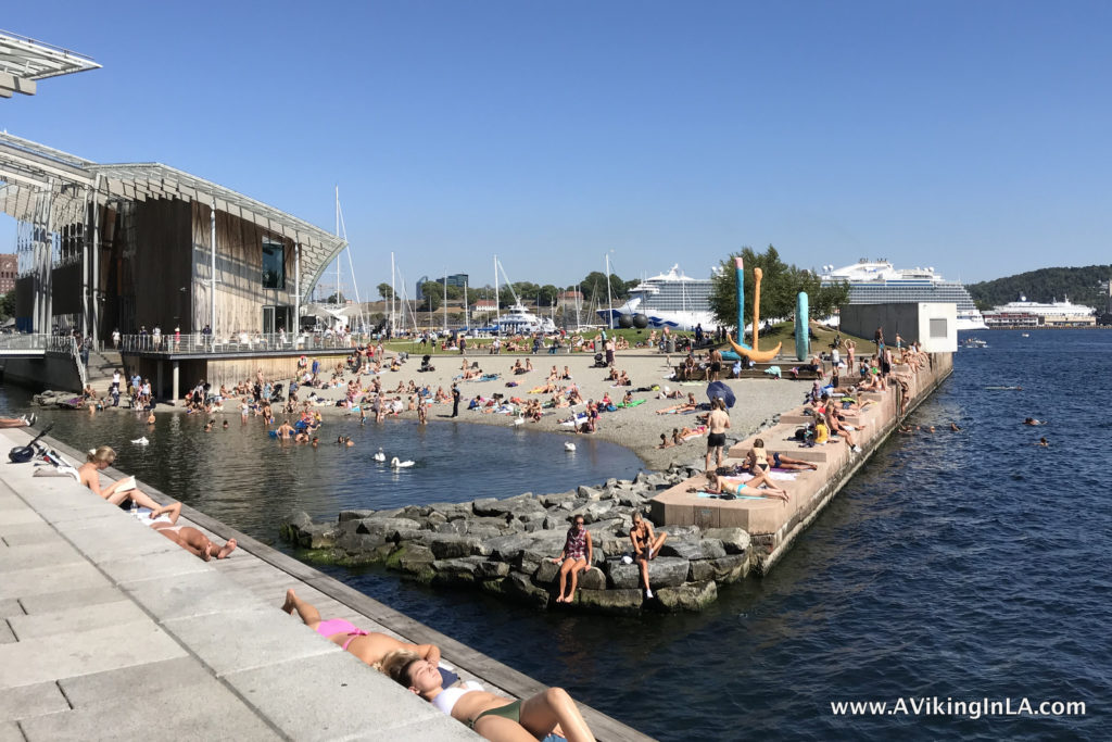
I realized too late that there is a lookout tower at Tjuvholmen as well, The Sneak Peak. It has a glass elevator that takes you up 117 feet for 360º views of the city, bay, and fjord. We’ll have to remember that for next time.

We wrapped up our promenade exploration just down the way at Aker Brygge (between Points #5 and #6 on the map), the original hotspot of the harbor area. Besides dining, shopping, people and boat watching to your heart’s content, you can visit the Nobel Peace Center in this area. It was actually on my wishlist for this summer because they are hosting the exhibition Generation Wealth (until August 21, 2018) which I missed when it was here in Los Angeles, but sadly we ran out of time.

We completed about half of the promenade this time around. The remaining stretch we’ll have to do next time we visit. Maybe we’ll do that with bikes since it brings us farther from home. Exploring Oslo’s Harbor Promenade has been on my Oslo bucket list for a while so I’m glad I finally had a chance to begin.

The New & Less Traveled Oslo

new and less traveled sightseeing in OsloAre you headed to Oslo this summer, and maybe you’re looking for something besides the normal tourist sights? Here are some newer sights and hidden gems to consider.

Harbor Promenade – Havnepromenade

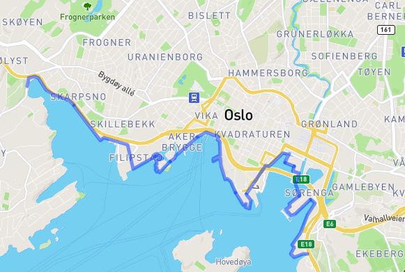
Oslo has a very new harbor promenade to explore. It runs 9 kilometers (about 5.5 miles) along the waterfront and hits many of the main sights of Oslo including Tjuvholmen and Aker Brygge, the inner harbor with City Hall and Akershus Fortress, and the Opera House.

I look forward to exploring this route by bike with the family. I may finally have a chance to get a close-up look at the Opera House with its dramatic architectural features. I also hope to include a swim at Sørenga Seawater Pool and a meal at Vippa (a huge warehouse recently named one of the “10 hottest new restaurants in Oslo” according to eater.com).

Hovedøya

A few years ago, a cousin of mine recommended a visit to
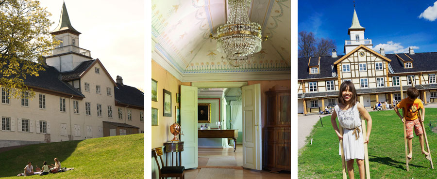
 Hovedøya, an island a short ferry ride from the city center known for its beaches, forests, and cultural heritage sights. There you can explore the ruins of a Cistercian monastery from 1147. In 1532, the monastery was pillaged and burned down, and the ruins weren’t excavated until 1840’s. You can also see two canon batteries from 1808 and two gunpowder depots from when the island belonged to the Norwegian army. It would be a nice excursion on a day with beautiful weather. Bring swim gear and a picnic (or eat at one of the cafes) and spend the day exploring. It also has plenty of geocaching opportunities (see map above with all the geocaches!) which is always a fun addition to an outing.

Museum of Oslo

Museum of Oslo is another museum I’d like to take the kids to. It’s located right in Frognerparken which makes it a convenient bike ride from my parents’ home. It presents the city’s history through models, paintings, and photographs. The museum’s exhibitions are mainly in Norwegian, but a free audioguide of “1,000 years in 20 minutes” is available in English, French, German, Somali, Punjabi, Polish, and Arabic as well as Norwegian.

What piqued my interest in bringing the kids was that the museum offers a special family activity called City Detectives (recommended for kids age 5 to 12). It’s an augmented reality app that allows visitors to get a glimpse of Oslo’s past. The goal is to find 10 historical stations in the exhibition “OsLove – City History for Beginners”. With the app, participants visit the 2-bedroom apartment of a big family, experience the power of Aker River, and see how the main street of Karl Johan has changed over time. The app is only available on site. You can borrow ipods or download the app to your own Apple device. You do not need to know Norwegian to use the app.

Emanuel Vigeland Mausoleum

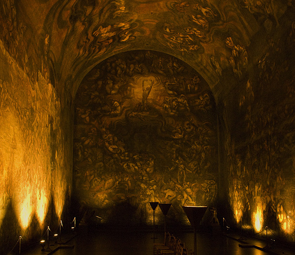
I learned about Emanuel Vigeland Mausoleum from the book Atlas Obscura: An Explorer’s Guide to the World’s Hidden Wonders. We are certainly familiar with the work of his brother Gustav Vigeland whose bronze and granite sculptures are on display in Frognerparken, but I did not know about Emanuel.

The mausoleum is part of Emanuel Vigeland Museum. The museum’s main attraction is a dark, barrel-vaulted room, completely covered with fresco paintings. According to Atlas Obscura, “entering the mausoleum is a solemn, even haunting, experience. Even the quietest footstep echoes across the barrel-vaulted ceiling for up to 14 seconds. A flashlight is needed to reveal the room’s dark, painted walls.” I think this “hidden wonder” is best explored without kids due to the paintings that show “life from conception till death, in dramatic and often explicitly erotic scenes.” (Note: The museum is only open to the public on Sundays. Summer hours are May 15 through September 15, 12pm to 5pm.)

Damstredet & Telthusbakken Area

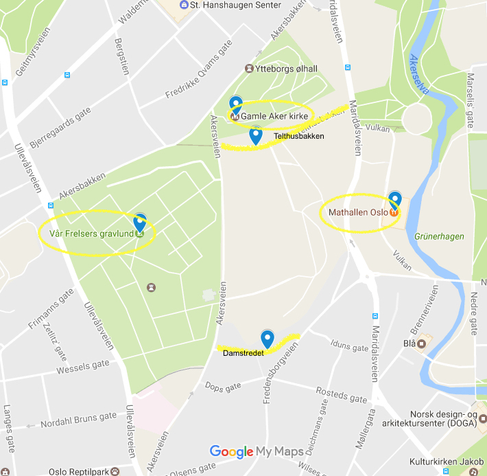
Damstredet and Telthusbakken are two roads known for their well-preserved and inhabited wooden houses built in the late 1700s and the 1800s. They are located near each other in the St. Hanshaugen/Gamle Aker area in central Oslo. There are other sights in the area as well, so a visit to the area can make a worthwhile self-guided walking tour. Very nearby is the medieval church Gamle Aker kirke (Old Aker Church), oldest building in Oslo, as well as Vår Frelsers Gravlund, the cemetery where writer Henrik Ibsen and painter Edvard Munch are buried. This excursion is easily combined with visit to nearby Mathallen, an interesting food court with specialty shops and cafés. And while at Mathallen, you can see if you can spot the Vulkan Bee Garden, which is two huge beehives on the rooftop between Mathallen and Dansens Hus next door.

Los Angeles Times’ Festival of Books: Metro, Authors, and even some Geocaching

Last year, as luck would have it, I was able to go to the Los Angeles Times’ Festival of Books both days. On Saturday, I went alone and explored and lingered as I pleased. On Sunday, Sonny joined me for a more intentional day. It was the perfect combination of experiences.

Saturday was a gray, dreary, rainy day, but I didn’t let that stop me. I donned my rain boots and rain jacket, packed an umbrella, and headed to our nearest Metro stop.

Taking the Metro made the excursion so easy. The closest stop was only a short drive away (and now it’s even closer with the Expo extension completed), and the stop at USC was right at the entrance to the festival. There were no hassles driving and finding my way and no expensive parking fees.

Due to the weather, the festival on Saturday wasn’t as lively as in previous years. There weren’t as many people roaming the grounds, and the booths were more closed up with plastic tarps on the sides. It did make maneuvering around more manageable, though. I easily browsed booths and listened in on stages where poets and authors spoke to more intimate audiences.

A highlight of the day was that I was able to get a ticket to a panel, also known as Conversations. I had never been to a Conversation. I had always been somewhat overwhelmed by the selection of offerings. Also, I’ve always been at the festival with family members who haven’t been interested in that aspect of it. This year, I just went to the ticket booth and looked to see what was still available in the next couple of hours. It limited my choices immensely and I was able to easily find something.

I actually had a choice of many open Conversations from which to choose. I selected a young adult nonfiction panel about bringing history to life for young adult readers. Sonny had recently read the young reader adaptations of the nonfiction books Unbroken by Laura Hillenbrand and Boys in the Boat by Daniel James Brown, which he had really enjoyed. I’m always on the lookout for possible interesting reads for him, and this panel seemed like a potential opportunity for that.

The panel was very interesting even though I wasn’t familiar with any of participants. Four authors of new non-fiction spoke about the process of bringing history to life for readers and then answered questions from the audience. I even bought a book by one of the panelists, Steve Sheinkin’s Most Dangerous: Daniel Ellsberg and the Secret History of the Vietnam War, and got it signed for Sonny for his birthday later in the month.

That evening I was on a high from my alone time at the festival. I was thrilled to have discovered how easy it was to go by Metro and how interesting panels could be. I looked to see if anything of interest was offered the next day. I found an available panel with middle grade authors, two of whom were favorites of Sonny’s, Stuart Gibbs (Spy School Series and FunJungle Series) and Pseudonymous Bosch (Secret Series and Bad Books Series). Sonny was interested but had his condition: he didn’t want to spend the whole day there. I reassured him it would only be a trip for the panel and food trucks and we’d be back home about 1 o’clock.

Sunday was a beautiful day, and I noticed a change already at the Metro stop. So many more people were headed to the festival. When we arrived at the festival, only about 30 minutes after opening, it was already very festive. Not only were more people there than the day before, but booths were more welcoming and music was playing.

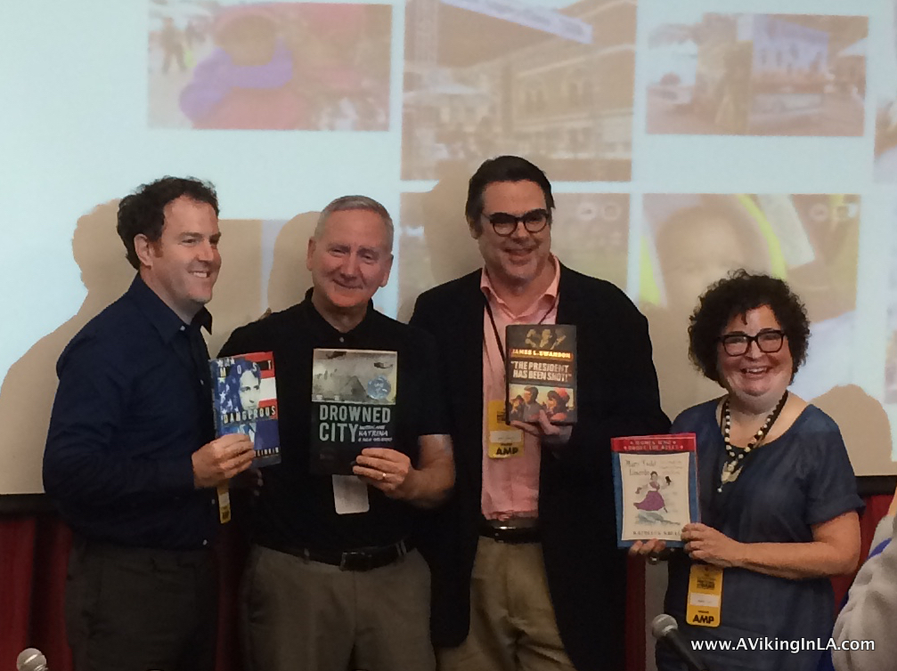
The panel was a popular one with many young readers in attendance. The panelists were engaging and shared insights into their writing lives. It was interesting to match a face, a voice, and a personality with the names we’d seen on book covers for so long. I wished, however, that Q&A time at the end had been limited to children. Their questions were so much better than adults’ questions.

Afterwards we joined many other fans in line to have books signed. And just as promised, we checked out the food trucks and Sonny settled on some gelato.

Then came the unexpected addition to our festival visit. After Sonny and I had agreed on the plans for the morning, I had looked to see what geocaching possibilities were there. I had totally forgotten about that when I was there alone the day before. It turns out there were three geocaches within the festival grounds, and I secretly planned a route to include those spots.

When Sonny heard about my geocaching hopes, he felt a little deceived. However, when it came down to it, he was eager to be the one to make the finds. He makes a good geocaching partner. We found one right in front of a security guard because no one thinks twice about a kid sticking his head up into a statue but an adult would have attracted attention.

A day alone and a morning with Sonny was the perfect way to experience the festival. I felt like I had a chance to take it all in – browse the booths, listen to authors on stage, attend panels, enjoy music performances, watch artists at work, and indulge in some treats from food trucks.

This year’s festival will take place the weekend of April 22 and 23, and once again, it will be at University of Southern California’s campus. The schedule can be found online, and you can reserve free tickets to indoor Conversations ($1 service fee applies to each ticket). A limited number of tickets for each Conversation will also be available at the festival ticketing booth each day — free of service charges — while supplies last. There are also plenty of outdoor Conversations on stages that do not require tickets. And admission to the whole festival is free. I highly recommend you take advantage of this LA event.

CicLAvia: Iconic Wilshire Boulevard (2016)

Another CicLAvia is in the books for me, my fifth one. It was a ride along Wilshire Boulevard starting in Downtown LA and going to Koreatown. I was actually considering not doing this ride because it was a partial repeat of a previous route I had already done, but then Doobie expressed interest in joining me and how could I resist that?

The first Iconic Wilshire Boulevard ride in 2014 was quite the city adventure on wheels for me. This one turned out to be much more relaxing. I really enjoyed the experience and am so glad I took advantage of the event and that Doobie joined me.

One Wilshire Hub

One Wilshire Hub

Now with the Metro Expo Line extended through our neighborhood, we had easy access to Downtown LA and we were at One Wilshire Hub in no time. Our biggest challenge was getting the bikes up from the underground station. We missed the elevator and Doobie had a little trouble holding on to his bike on the busy escalators. But it all worked out with the help of friendly and helpful fellow commuters.

CicLAvia Wilshire routemap

Since I had already done this route (although the 2014 version was about twice as long), I did not really have any particular plans, unlike CicLAvia: Heart of LA (2015)  when I had a whole wishlist of places I wanted to see and visit. This time, I just wanted to enjoy and take advantage of the open streets (and hopefully find one geocache that was along the route, a new one since my last ride there).

Doobie, however, had an agenda. He wanted to hunt Pokémon, stop at PokéStops and Gyms, and hatch eggs. I was totally okay with that. It would give me ample time to people watch and take in the whole atmosphere of the event. On their website, CicLAvia even had a list of the 56 PokéStops along the route with a reminder to be mindful and not to stop in the middle of the route. Continue reading

Summer in Norway: Exploring the Coastal Trail in Kragerø

A new favorite activity during our annual summer trip to Norway is exploring Kyststien i Kragerø, a hiking trail through the municipality of Kragerø following the coastline as much as possible. Our summer home is on an island, but the trail passes right by on the mainland a very short boat ride away.

Kyststien 2015 Soppekilen

The Coastal Trail in Kragerø is a relatively new part of our summer consciousness. It officially opened in November 2013, so this year was our third summer with it. It’s part of an effort to have a continuous trail all the way from Oslo to Stavanger. The idea was to use the old road system that once followed the coastline.

The complete trail in Kragerø is about 40 kilometers/25 miles long, and it is divided into 3 stretches (Fossing – Helle, Helle – Kragerø, and Stabbestad – Ellingsvika). Remnants of the old road system remain but only in small areas. Most of it is under private docks and lawns. The trail runs along the coastline where possible, but at times it has to swing into the woods or over a mountain ridge. Continue reading

CicLAvia: Heart of LA (2015)

Last month I completed another successful and fulfilling CicLAvia experience. It was my fourth one, and each one has always been such a different and unique experience. I’ve gone through various iterations of family joining me: 6-year-old Doobie the first time in 2013, me alone the second time in 2014, the whole family the third time earlier this year, but it was just 11-year-old Sonny and me for this experience.
MacArthur Park SpheresOn October 18, 2015, CicLAvia celebrated its 5th anniversary with CicLAvia: Heart of LA, a route in Downtown LA. I studied up on the route so I wouldn’t miss anything of interest and had a great plan for the day. I had never planned and prepared so much for a CicLAvia experience as I did for this one, but it was such a new area for me to explore. Now that it’s over, I learned it was certainly helpful to have a general overview of how I hoped to proceed that day, but that an overly detailed plan was not necessary nor feasible and it’s just best to go with the flow.

CicLAvia Heart of LA mapOther than we didn’t get out as early as I would have liked since Sonny had been at a sleepover, all started well as we rode our bikes to the Metro Rail and took it to the end of the line downtown. We first headed out to MacArthur Park as planned and saw the The Spheres as I had wanted. They didn’t disappoint, but it was kind of an odd experience walking through the park—there was the energy and excitement of all the CicLAvia participants, but at the same time homeless people were going about their business as if nothing special was happening.

MacArthur Park More SpheresOur first stop at MacArthur Park was also where I realized all my plans would not work out as planned, in particular the geocaching ones. There were four geocaches in this area that I had wanted to search for. I quickly dropped two of them since they were on the opposite side of the park. We made half-hearted, unsuccessful attempts to find the other two; there were just too many “muggles” around to search without drawing too much attention to us. Sadly, I figured that would probably be the case for all, if not most, of the geocaches I had picked out along the route.

MacArthur Park HubBefore moving on, we checked out the many food trucks at MacArthur Park Hub. Sonny gave The Pudding Truck a try. The butterscotch pudding with brownie bites hit the spot before hitting the road again.

Pudding TruckOn the way towards Grand Park Hub, I had planned to stop by Clifton’s Brookdale Cafeteria, The Last Bookstore, and the Globe Lobby of the LA Times building to see their unique interiors, but they were all on the wrong side of the street and the flow of the bike traffic just carried us along past them. Same was the case for a couple of geocaches along the way as well. There was still the chance we might be able to check them out on the way back.

DowntownLABefore we knew it, we had reached Grand Park Hub. We continued on towards Little Tokyo, which was my next planned stop. On the outskirts of Little Tokyo, however, was a puzzle geocache I had prepared for and wanted to try if at all possible.

For this geocache, I had been given an old photo of City Hall from the 1950’s and had to figure out the spot from which the photo had been taken. The container would be in an “obvious spot” just a few feet from that location. If I had solved the puzzle correctly, ground zero was right along the route, too tempting to let pass by.

City Hall 1950s

Luckily, the spot was on our side of the street and it wasn’t busy. We were able to locate and make the grab easily😀. Interesting to see the differences and similarities in the area between then and now!

City Hall 2015We parked our bikes when we got to the historic district of Little Tokyo. It wasn’t an official hub, but it was very busy with people exploring the area. We took a little stroll in Japanese Village Plaza and felt like we were in Japan. We enjoyed a drumming demonstration outside the Japanese American National Museum. We even ventured a little beyond the crowds to the Go For Broke Memorial which commemorates Japanese Americans who served in the United States Military during World War II (where we also had a some time to ourselves and were able to search for a traditional geocache😀).

Little TokyoTime was quickly passing and Sonny was beginning to get a little impatient about all the time he’d already spent out on the streets with me. We got back on our bikes and pedaled through the Arts District, over 4th Street Bridge, and on towards Hollenbeck Park in Boyle Heights.

Art DistrictWe enjoyed lunch from a food truck at Hollenbeck Park. What struck me right away was how green the park was! These days, with the drought and cutbacks in watering, so much grass is usually brown, but not here for some reason.

Hollenbeck ParkRiding 4th Street Bridge was my favorite stretch of the day. There was something about riding on this historic bridge built in 1931—with its Gothic Revival details, over all the railroad tracks and cemented LA River underneath, with the openness and views of the mountains and city around us—that awed me. It was a popular place for cyclists to get off their bikes and admire their surroundings. And I loved that we got to ride it twice, once in each direction coming back and forth from Hollenbeck Park.

4th Str Bridge to Hollenbeck Park 6th Str Bridge4th Str Bridge to DTLAAfter lunch we pretty much peddled straight back to the downtown Metro stop to go back home. Sonny passed up a stop at a frozen yogurt place because he was eager to get home, but he did humor me with a quick stop right along the route near City Hall to take a picture of a sign post listing all the sister cities of Los Angeles. This was part of the requirement for a virtual geocache that I wanted to log (the other half was posting a picture from a visit to one of LA’s sister cities, which in our case was Athens, Greece😀).

Sister Cities GeocacheHe also agreed to stop at The Last Bookstore to get a glimpse of that. I enticed him with the promise of a book. We browsed the downstairs, in particular the vinyl records section (a cultural history lesson for Sonny!) and the children’s and young adults’ book sections, before we headed upstairs and walked through the labyrinth. It was a short but sweet visit, and we learned it’s worth another visit if we’re in the area.

The Last BookstoreAt the end of the day, we had cycled 13 ½ miles and been out from about 10am to 4pm. We had explored a great part of Downtown that until now had been unknown and unfamiliar to us. I can’t say I now know it like my own neighborhood, but I am certainly more interested and open to going back and revisiting and exploring some more. Downtown LA is no longer a big, unknown area to me. Now when I drive along the freeway past the high rises and surrounding areas, I’ll have a new understanding and appreciation for the area. I’m always looking for new activities to do with my family when they visit. Now I can put some places in Downtown LA on our list.

For those interested in participating in a future CicLAvia, there are two events coming up in the next few months. The first one is CicLAvia: The Valley on March 6, 2016, and the next one is CicLAvia: Southeast Cities on May 15, 2016. Are you tempted to mark either of those on your calendar? I hope to be able to do the Southeast Cities one.

Wishlist for CicLAvia: Heart of LA

CicLAvias have become one of my favorite LA events. I’ve participated in three and am eagerly looking forward to the next one which is around the corner. CicLAvia is an opportunity to venture out and explore neighborhoods on streets that are totally closed to traffic. It also provides the perfect playground for another of my favorite activities, geocaching. Bicycling is my preferred way to experience CicLAvia, but you can also participate by foot or in any other non-motorized way. CicLAvias are fun urban adventures in our own backyard with an amazingly diverse group of people from all over the city.

CicLAvia Heart of LA mapThe next CicLAvia is on Sunday, October 18, and will take place in downtown LA, in the heart of LA. It will go through many varied and distinct districts: Historic Core, Civic Center, Little Tokyo, the Arts District and as far west as MacArthur Park and east as Boyle Heights.

MacArthur Park at CicLAvia: Iconic Wilshire (April 2014)

MacArthur Park at CicLAvia: Iconic Wilshire (April 2014)

Some of those areas I’ve been to before. For example, at CicLAvia: Iconic Wilshire I rode through MacArthur Park, I’ve taken visiting family to Chinatown, and I’ve been to the Civic Center area for visa and citizenship appointments. But others, such as the Arts District, Historic Core, Little Tokyo, and Boyle Heights, I could hardly place on the map until I looked more closely at downtown LA in preparation for this CicLAvia.

I’m putting together a little wishlist of sorts to make sure I don’t miss any fun and unique experiences and sights on the day of the event. As I know from my experiences at previous CicLAvias, the best laid plans often go awry, but planning is half the fun. Continue reading

Checked Off My California Bucket List: Hike to the Hollywood Sign!

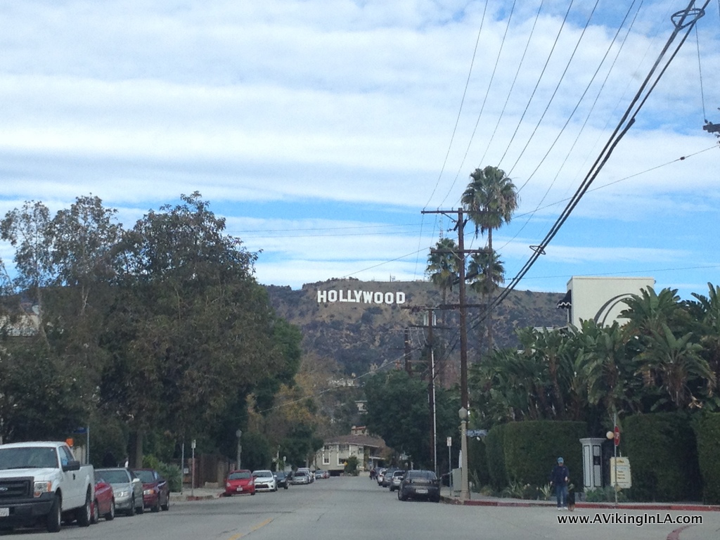
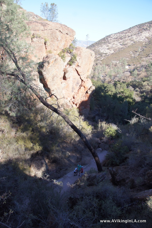
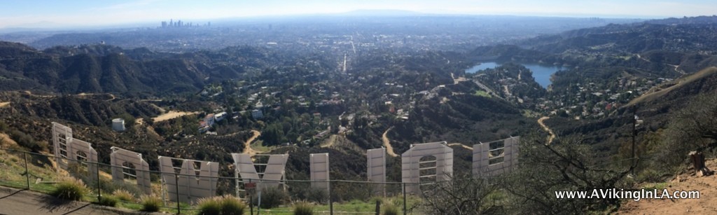
A hike to the Hollywood Sign has been on my California bucket list for a long time. About two years ago, our family attempted, but we failed. It was a new area to us and we started our outing too late in the day. I chalked it up as being a reconnaissance mission for a future visit.

This past holiday season I finally had a chance to try again. My family was in town for the holidays, and my 11-year-old niece expressed an interest in getting a good view of the sign. Quickly, a little group was assembled for an excursion to the sign. We were my sister, my niece, and my father (in the best attire he had for a hike—slacks and loafers!).

The view as we drove up Beachwood Canyon Drive, approaching what we thought would be the start of our hike

The view as we drove up Beachwood Canyon Drive, approaching what we thought would be the start of our hike

We had a little hiccup in the beginning. I began by taking them to the trailhead at the top of Beachwood Canyon, which I had figured out on our reconnaissance mission was a good place to start. I knew there had been some issues between neighbors and hikers/tourists and faintly remembered that the trailhead had been closed for a while, but I thought that was over. Turns out it wasn’t. The parking at the trailhead was still closed, but there were handouts that suggested we go to Griffith Observatory and begin our hike from there. We had no time constraints so we headed over there. Continue reading

CicLAvia: Iconic Wilshire Boulevard (2014)

A City Adventure on Wheels

About a year ago I rode in my first CicLAvia event. We had planned for it to be a whole family excursion, but instead it became just a Doobie and Mommy outing. Since then I’ve looked forward to the whole family participating in the next one. Our next opportunity came around not long ago, Iconic Wilshire Boulevard on April 6.

CicLAvia Iconic Wilshire Blvd Route

But due to various circumstances, I ended up going solo. After the initial disappointment of having to go alone, I actually looked forward to it since I would only have to worry about myself and I could do exactly what I wanted and spend as much time doing it as I pleased. I was going to make this a city adventure like I’d never had before!

The first part of my adventure was using the Metro Rail line near our neighborhood for the first time. The Expo Line’s last stop was only a few minutes’ bike ride from our home, and the line went directly to the start of the route Downtown. It was a no-brainer to ride the Metro, but I had no idea about the logistics of using it, especially with a bike. However, I’ve used public transportation in other major cities and felt confident that I could figure it out here, too. It turns out there was no need to worry. At the station, there were extra attendants on duty to help us newbies with buying TAP cards and figuring out fares. I didn’t even have a chance to wonder where to start.

Wilshire One Hub Beginning

When I surfaced from the underground station Downtown, I was immediately surrounded by cyclists. Continue reading

Pinnacles National Park: Highly Recommended!

Pinnacles trailThe other weekend we had an amazing visit to Pinnacles National Park, California’s newest national park (it used to be a national monument). Located in central California, Pinnacles is known for its towering rock formations and talus caves. It’s a hikers’ and climbers’ paradise. The area has also played a critical role in the recovery of the California condor.

SONY DSC

We needed to take a weekend trip to central California to visit Mission San Juan Bautista, which Sonny had been assigned for his school project. Since it was my responsibility to plan the mission trip, I took the liberty of scheduling a stop at Pinnacles on our way home. The kids adamantly objected to the planned visit, but afterwards they reluctantly agreed it was pretty fun and adventurous after all.Pinnacles hiking boulders

Some national parks are drive-through parks, meaning you can drive along a designated road and see much of the park. Pinnacles, however, is not such a park. You have to view it by foot.

Pinnacles hikingThere are two entrances to the park, East and West. You cannot drive from one to the other so you have to figure out which one is best for you. After some research (and much appreciation goes to ChasquiMom’s blog post about her visit to the park), I decided that the East Entrance would be the best choice for us and that our goal would be to hike to Bear Gulch Caves and the reservoir. It seemed like the ideal way to visit the park for the first time, especially with kids.

We visited Pinnacles on Martin Luther King, Jr. Day. We did not realize it was a fee-free day and hence we were not alone at the park. Our plan was to park at the Bear Gulch Day Use Area and hike from there. However, that parking lot was full when we arrived. Fortunately, the park had a shuttle going from the Visitor Center to the trailhead for Bear Gulch Cave. The shuttle only took 24 people at a time so we had to wait for the second pick-up. Good thing my accompanying family members were amenable to waiting about 40 minutes because the alternative was hiking 3 miles uphill to the trailhead. When our shuttle arrived, we both sat with a kid on our laps, as did several other families, and our adventure in Pinnacles began.Pinnacles shuttle

The hike was awesome. It was not your normal hike along a fire road or single track trail. We hiked along cliff edges, under cliff ledges, through rock tunnels, and into pitch dark caves, just to mention some of the highlights. On rock faces at several locations, we saw rock climbers making their way up. The kids had no opportunity to complain or whine as around every curve was something new and different. Also, there were kids of all ages along the trail, so they were constantly reminded that we weren’t dragging them along on something that wasn’t for kids.Pinnacles boulders

On our way up, we took the Moses Spring Trail. When we arrived at the off-shoot for the caves, we ventured boldly through them. We had been warned that we would have to crawl on our knees at one point, but we actually didn’t have to. We just crouched really low. It was pitch black in certain places, and we were grateful for the two flashlights I had brought. Click on a picture to see a larger version.

When we reached the end of the cave, we were uncertain if the trail would lead us to the reservoir or just back down to the trailhead. We couldn’t really tell from the map since we didn’t know exactly where we were. Instead of risking missing the reservoir, we headed back through the cave, now feeling like experts going through it.

Pinnacles MonolithWe rejoined the trail we had left and continued onwards to the reservoir, passing underneath the Monolith (a huge boulder stuck in the gulch) before ascending to the peaceful reservoir just beyond.

Pinnacles Bear Gulch ReservoirThe reservoir was a perfect destination point. We found a place to sit and enjoyed our snacks while watching rock climbers work their way up the face of a rock. At one point, we decided we should head back to the car. To get back, we took the Rim Trail instead of backtracking down through Bear Gulch. The Rim Trail was a more normal trail, no exciting tunnels and caves, but it had very nice views of the gulch below and the area beyond. And we didn’t meet any other people along this trail which was a nice change from before. The trail coming up got very busy at times. In one way, it was great to see so many people interested in nature and the national park, but at the same time, it sometimes felt too crowded.

Pinnacles Rim Trail

And now, what would an excursion in nature like this be without geocaching for me? There was a geocache placed just outside the entrance to the park which we found easily. Physical geocaches, however, are not allowed on lands administered by the National Park Services (though there are some exceptions). Inside the park, however, there was an EarthCache. An EarthCache is a type of virtual cache that teaches the visitor something about how the place was formed or why the place is important scientifically. In this EarthCache, we learned about the geologic and volcanic history of Pinnacles. Logging requirements were just to look through the displays at the visitor center and find something that the writer hadn’t included in their text. Simple enough.

If you’re driving through this part of central California or looking for a fun, outdoorsy weekend trip, I very highly recommend a visit to Pinnacles. You can hike, or climb, to your heart’s content. There are 30+ miles of trails, something for every ability. What we did was perfect for families, a 2.2 mile hike with great variety and adventure. I would love to go back and hike a longer trail that goes farther into the park. I have my eyes set on a hike along High Peaks Trail to Scout Peak or a hike along Balconies Trail to explore the Balconies Cave. It would be really cool to catch a glimpse of a California condor as well.

Pinnacles detail map