Norway’s Telemark Canal & Family History, This Time with Kids

My paternal grandparents took great pride in showing their grandkids the greatness of Norway. We went on a variety of trips with them, most of them outdoorsy, both near and far. The last trip my sister and I took with them was a boat ride along the Telemark Canal in southern Norway in 1997. Bonding while experiencing the Telemark Canal with its historic canal boats, numerous locks, and beautiful scenery was not the sole purpose of the trip, however. Dalen, a little town at the end of the canal route, had familial historical significance which our grandfather wanted to share with us.

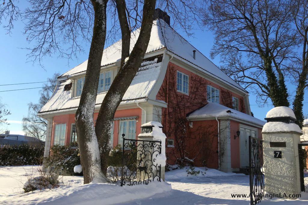
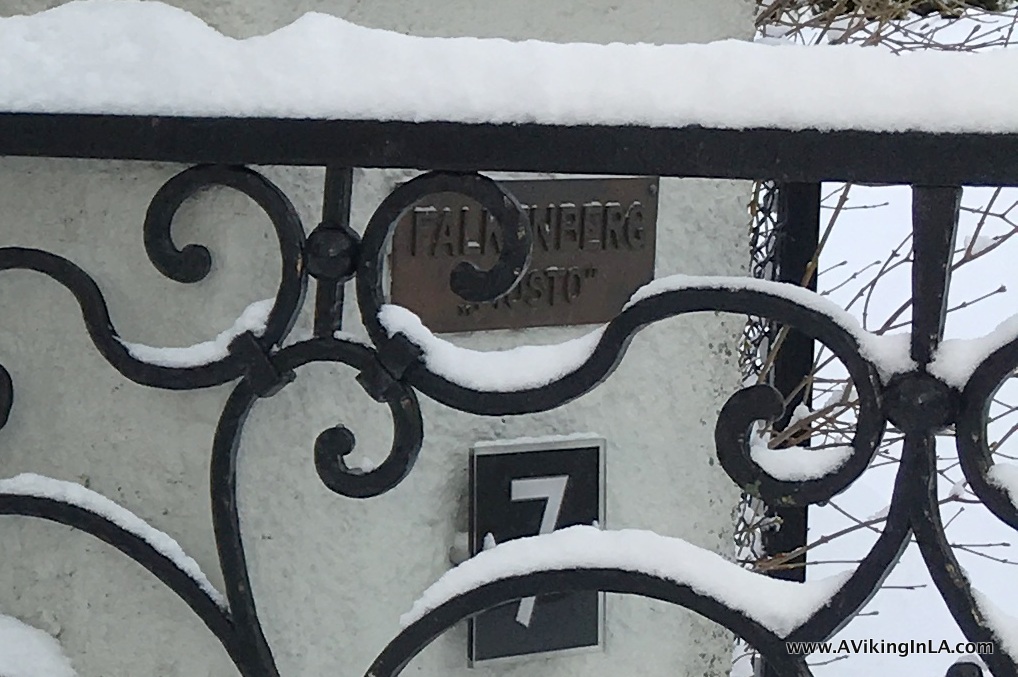
We are reminded of this piece of family history every time we’re in Oslo because the name of my parents’ home, Mosto, comes from that time in our family history. The home even has its own nameplate on the gate post.

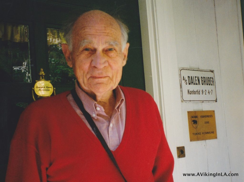
My grandfather was born February 25, 1915, when World War I was raging outside of Norway (1914-1918). His father was an engineer with a specialty in mining, and later that year, he along with his father and others, founded A/S Dalen Gruber (Dalen Mines), a molybdenum mine, of which my great grandfather became the director. Molybdenum was an important metal for the war industry. Once separated from other materials, it was mixed with steel to make armor steel. After the ore was mined, it was crushed, washed, and sent onwards via boat through the canal (which had been completed in 1892). It was mostly exported to England. The mine was in operation from 1916 to 1919, when suddenly there was no more ore to be mined. (View source and pictures of the mine).

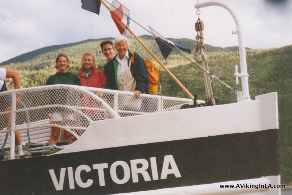
In 1997, my sister and I (and my sister’s husband-to-be; my fiancé had to return to LA for work) boarded M/S Victoria in Skien with my grandparents and spent a leisurely day motoring through the Telemark Canal with its eight lock systems connecting lakes and rivers.

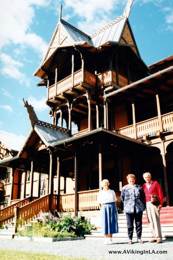
We wrapped up our exploration of Telemarkskanalen with a stay at historic Dalen Hotel. Dalen Hotel opened in 1894 and was highly regarded in Europe with visits by royalties and other prominent guests. It’s known as the “fairytale” or “dragon hotel,” its architecture inspired by the Viking era and stave churches. It’s really a sight to be seen!


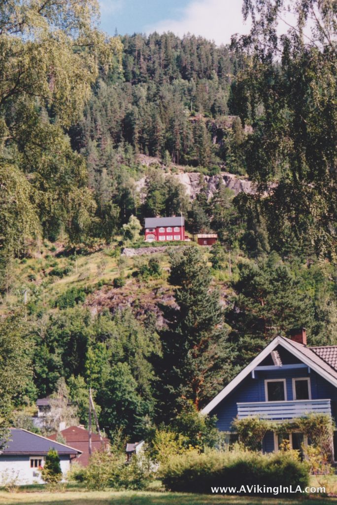
The house in which my grandfather’s family lived in Dalen for three years is the only building left of all mining operations. It is easily seen from the parking lot of Dalen Hotel, the red house up on the hillside.

With my grandfather, we even made our way up to the house for a closer look. When his family left Dalen in 1918, they moved to Oslo and into a newly constructed home. They named the house “Mosto” which is derived from MoS2 (sorry, can’t do the subscript 2), the chemical formula for molybdenite, the principal ore for molybdenum. This is the home my parents now live in.

This summer it was my parents’ turn to show their grandkids some of the greatness of Norway, and my husband and I came along, too. Telemarkskanalen and Dalen were of course on the itinerary (but by car, not boat) and my parents had added some other notable historical and geographical sights as well which I was very eager to see.

Click map for a closer view.

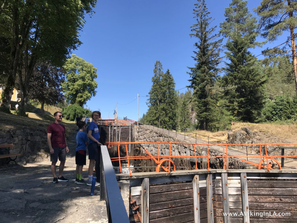
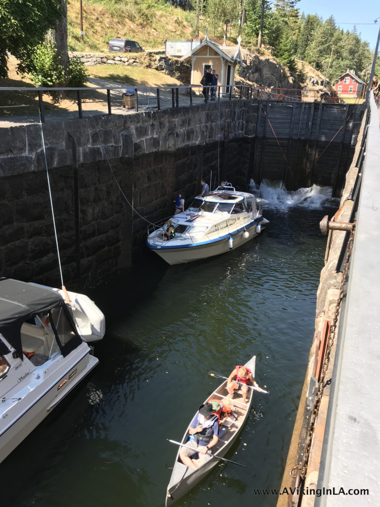
The road trip started from my parents’ summer home in Kragerø along the coast. To get a feel for what Telemarkskanalen is, we stopped at Vrangfoss Locks, the largest and most impressive of the eight lock systems along the canal. Coincidentally, we timed our stop perfectly and had the chance to watch as two leisure boats plus a canoe went through the lock system. It’s interesting to note that all the work – opening and closing of each of the 5 five chambers of the lock system – is still done manually by a team of about 4 people. It takes about 45 minutes to pass through the whole lock system at Vrangfoss.

After our stop at Vrangfoss, our road trip took us away from Telemarkskanalen to Heddal Stave Church, an 800-year-old wooden church and Norway’s largest stave church. Stave churches are a unique feature of Norway’s cultural history. Researches believe there were just under 2,000 stave churches in Norway at one point. Only 28 remain. I’m glad to have added another to my boys’ repertoire. They have now visited three stave churches – Heddal, Lom (last summer’s road trip), and the reconstructed Gol Stave Church in Oslo at the Norwegian Museum of Cultural History.

After exploring Heddal Stave Church and its intricate carvings, we headed up into the mountains for a two-night stay near the mountain top Gaustatoppen and sight-seeing in the area (which will be its own blog post).

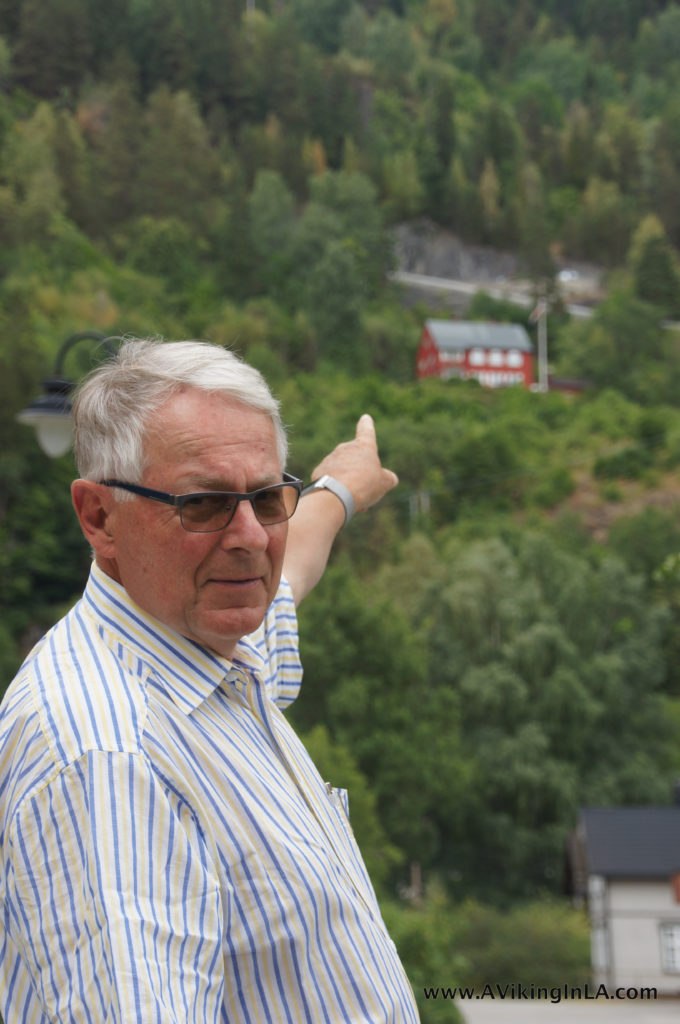
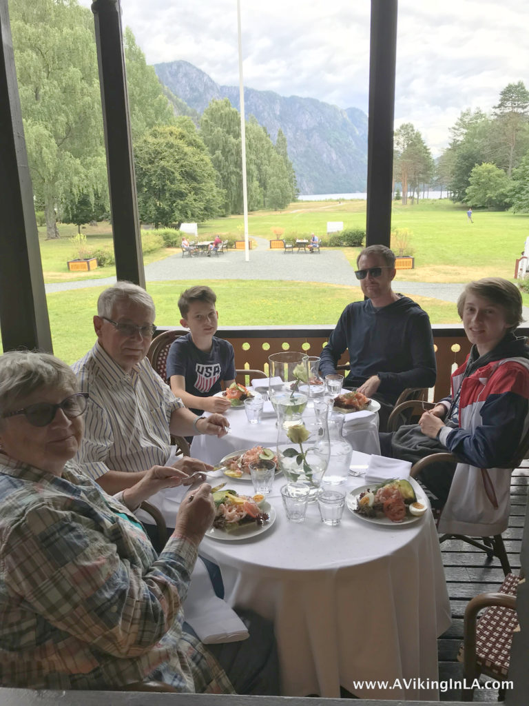
Two days later, on our return to Kragerø, we revisited Telemarkskanalen, specifically Dalen. My father pointed out his father’s early childhood home up on the hillside and we discussed the connection to their home in Oslo. At Dalen Hotel we enjoyed a late lunch with a view of the lake before getting back on the road.


This wrapped up the experiential family history lesson. I’m grateful to my parents for making this trip possible, and I’m happy my kids now have an understanding of and connection to the name of the Oslo home they visit every summer.

P.S. Would you like to experience the Telemark Canal yourself? You could of course travel to Norway and do so in person, but Netflix also offers you the opportunity to experience the daylong adventure from the comfort of your own coach and at your own pacing at Slow TV: The Telemark Canal (fast forward to 3:36:00 to watch as M/S Victoria nears Vrangfoss Locks).

Checked Off My Norway Bucket List: Drive the Atlantic Road!

I’ve been fascinated by the Atlantic Road on Norway’s west coast since I learned about it a few years ago. It looked like a real life rollercoaster ride hopping from island to island along the outermost edge of the coast. Bad weather seemed to make it even more extraordinary.

Photo credit: www.visitnorway.com

The road is one of Norway’s 18 official national tourist routes. It opened in 1989, and in 2005, it was voted Norway’s “Engineering Feat of the Century”. It is built on several small islands, skerries, and landfills and is spanned by seven bridges. Many consider it one of the world’s most beautiful drives as well.

We came at it from the north via Kristiansund after a visit to Trondheim. We drove through Atlantic Ocean Tunnel (an undersea tunnel about 3.5 miles long) from Kristiansund to the island of Averøy and made our way along Route 64 with a final destination of Molde.

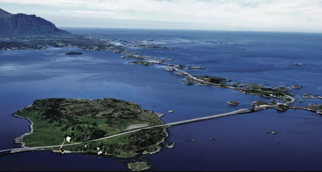
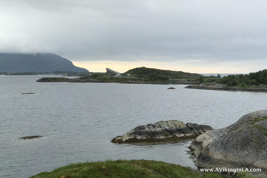
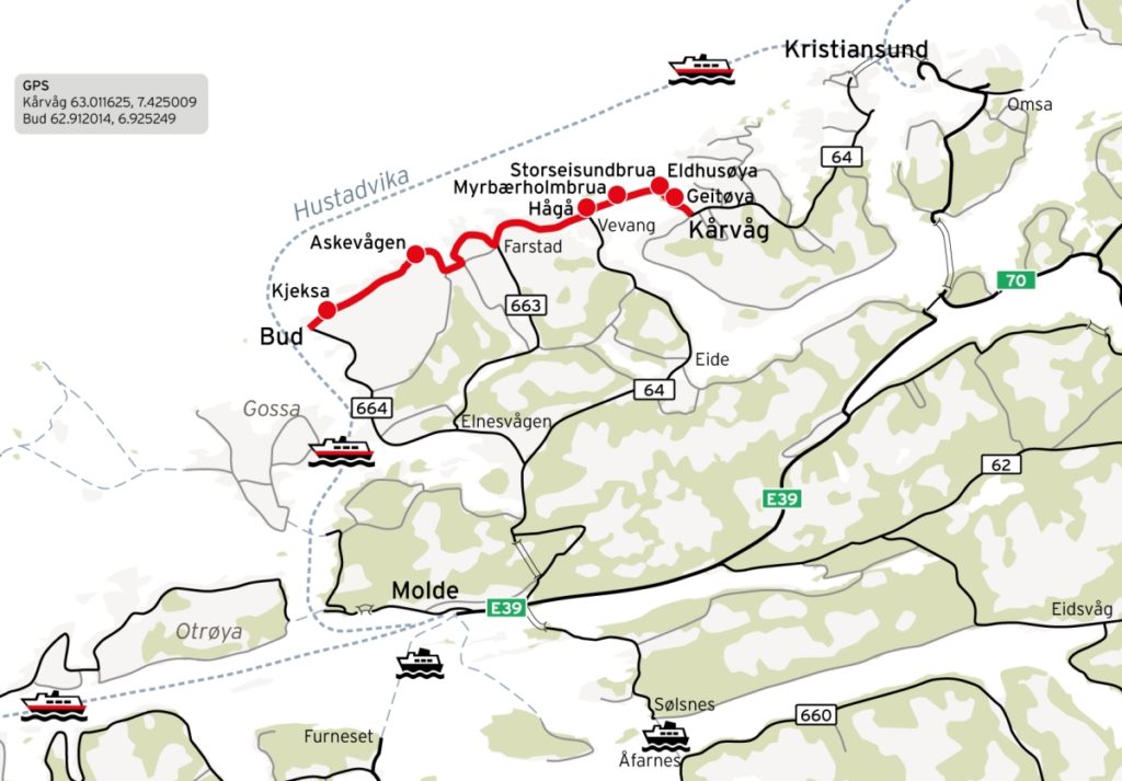
A quick Internet search of the Atlantic Road will tell you it is a 5-mile stretch between Kårvåg and Vevang along Route 64 (WikipediaGoogle Maps, various articles). However, as you can see on the official site of National Tourist Routes in Norway, the full route is actually about 22 miles and goes all the way to Bud from Kårvåg on a series of smaller roads (Roads 64/242/663/238/235). The most dramatic stretch, however, is probably the 5-mile section between Kårvåg and Vevang.

Due to time constraints, we were unfortunately only able to drive the 5-mile stretch. Bad weather during our stay in Trondheim meant we had to use the morning of our departure for some must-see sightseeing and so we got on the road much later than planned. Also, we were delayed by an unexpected ferry ride which added some down time to our drive.

We didn’t get to the start of the Atlantic Road until 6:30PM! Yes, it stays light late during summertime, but we still had to get to our hotel in Molde that day and the kids could only handle so much in a day. And our stomachs were getting hungry for dinner as well.

For us, the weather was neither good nor bad. It was cloudy and drizzled on and off. In one way, that was good because it allowed us to get out of the car without getting soaked. But, on the other hand, a beautiful evening sun and clear skies would have added greatly to our enjoyment of the area.

Despite the constrained time and lackluster weather, it was an interesting experience to drive along the Atlantic Road and I’m glad we went out of our way to do it, but I was a little underwhelmed and feel it merits a revisit. Part of the reason I felt a little underwhelmed was that 5 miles is a very short stretch after 4 ½ hours of driving from Trondheim. Had we had time to drive and explore the full route I’m sure we would have felt it much more worthwhile.

The family along hiking path on Eldhusøya with Storseisundbrua in background

For us, the highlights were a short walk around the island of Eldhusøya and the drive over the main bridge Storseisundbrua. The island of Eldhusøya has an elevated path that goes around the island and provides views of the open ocean beyond. Along the path, there is a memorial to those lost at sea (and even a geocache!). Storseisundbrua is the longest bridge on the route and the route’s symbol. As you hit to crest of the bridge, you get a wonderful view of the road and the many little islands ahead. Too bad there wasn’t a stopping point there. Another interesting bridge we crossed was Myrbærholmbrua. It has specially built fishing walkways on either side. Had we had more time I would have liked to park and walk along them to see what kind of fish they were pulling in.

At the top of Storseisundbrua with a view of road and small islands ahead

The rest of the tourist route after we turned off for Molde seems to have some interesting attractions as well: Hågå with the broken-looking serpent-like marble sculpture called Columna Transatlantica, Askevågen at the end of the breakwater with glass walls for protection against the weather and spray, and Kjeksa with paths and steps leading down to the edge of the sea. They all seem worthy of visits. (Photo credits for images below: Nasjonale turistveger)

Once back in Los Angeles, my aunt shared with me a Norwegian article and video from Møre og Romsdal Reiseliv’s website describing seven “fresh experiences” you should make time for if you’re visiting the Atlantic Road.

As seen in the video, they recommend making time for the following activities:

  1. Float 550 meter around Eldhusøya (walk the elevated path)
  2. Go deep sea fishing with an expert (or fish off the walkways on the bridges)
  3. Visit the coastal town of Håholmen (and eat clipfish and experience Viking culture)
  4. See the artwork Columna Transatlantica
  5. Bike or hike the coastal trail at Farstad
  6. Windsurf or kitesurf on Farstadstranda
  7. Hike to the top of Stemshesten for an alternate view of Atlantic Road

One of those experiences, the Eldhusøya visit, we did have a chance to do, and others would not have been appropriate for our family, but I would have loved the opportunity to visit Håholmen, hike the coastal trail at Farstad, and see Columna Transatlantica with our own eyes (does it really look like toothpaste as my kids believe?). Those activities are on my list for next time.

My tips for travelers headed to the Atlantic Road – make sure you have lots of time to enjoy and explore and plan to drive the whole 22-mile route. If I have the opportunity to return to the area, driving the whole route with time to spare will be top priority. I would even consider bookending my visit with nights in Kristiansund and Molde (or maybe even on Håholmen) so that I could have a whole day along the route. The Atlantic Road deserves so much more time than we were able to give it, but I really enjoyed the introduction to it.

Pinnacles National Park: Highly Recommended!

Pinnacles trailThe other weekend we had an amazing visit to Pinnacles National Park, California’s newest national park (it used to be a national monument). Located in central California, Pinnacles is known for its towering rock formations and talus caves. It’s a hikers’ and climbers’ paradise. The area has also played a critical role in the recovery of the California condor.

SONY DSC

We needed to take a weekend trip to central California to visit Mission San Juan Bautista, which Sonny had been assigned for his school project. Since it was my responsibility to plan the mission trip, I took the liberty of scheduling a stop at Pinnacles on our way home. The kids adamantly objected to the planned visit, but afterwards they reluctantly agreed it was pretty fun and adventurous after all.Pinnacles hiking boulders

Some national parks are drive-through parks, meaning you can drive along a designated road and see much of the park. Pinnacles, however, is not such a park. You have to view it by foot.

Pinnacles hikingThere are two entrances to the park, East and West. You cannot drive from one to the other so you have to figure out which one is best for you. After some research (and much appreciation goes to ChasquiMom’s blog post about her visit to the park), I decided that the East Entrance would be the best choice for us and that our goal would be to hike to Bear Gulch Caves and the reservoir. It seemed like the ideal way to visit the park for the first time, especially with kids.

We visited Pinnacles on Martin Luther King, Jr. Day. We did not realize it was a fee-free day and hence we were not alone at the park. Our plan was to park at the Bear Gulch Day Use Area and hike from there. However, that parking lot was full when we arrived. Fortunately, the park had a shuttle going from the Visitor Center to the trailhead for Bear Gulch Cave. The shuttle only took 24 people at a time so we had to wait for the second pick-up. Good thing my accompanying family members were amenable to waiting about 40 minutes because the alternative was hiking 3 miles uphill to the trailhead. When our shuttle arrived, we both sat with a kid on our laps, as did several other families, and our adventure in Pinnacles began.Pinnacles shuttle

The hike was awesome. It was not your normal hike along a fire road or single track trail. We hiked along cliff edges, under cliff ledges, through rock tunnels, and into pitch dark caves, just to mention some of the highlights. On rock faces at several locations, we saw rock climbers making their way up. The kids had no opportunity to complain or whine as around every curve was something new and different. Also, there were kids of all ages along the trail, so they were constantly reminded that we weren’t dragging them along on something that wasn’t for kids.Pinnacles boulders

On our way up, we took the Moses Spring Trail. When we arrived at the off-shoot for the caves, we ventured boldly through them. We had been warned that we would have to crawl on our knees at one point, but we actually didn’t have to. We just crouched really low. It was pitch black in certain places, and we were grateful for the two flashlights I had brought. Click on a picture to see a larger version.

When we reached the end of the cave, we were uncertain if the trail would lead us to the reservoir or just back down to the trailhead. We couldn’t really tell from the map since we didn’t know exactly where we were. Instead of risking missing the reservoir, we headed back through the cave, now feeling like experts going through it.

Pinnacles MonolithWe rejoined the trail we had left and continued onwards to the reservoir, passing underneath the Monolith (a huge boulder stuck in the gulch) before ascending to the peaceful reservoir just beyond.

Pinnacles Bear Gulch ReservoirThe reservoir was a perfect destination point. We found a place to sit and enjoyed our snacks while watching rock climbers work their way up the face of a rock. At one point, we decided we should head back to the car. To get back, we took the Rim Trail instead of backtracking down through Bear Gulch. The Rim Trail was a more normal trail, no exciting tunnels and caves, but it had very nice views of the gulch below and the area beyond. And we didn’t meet any other people along this trail which was a nice change from before. The trail coming up got very busy at times. In one way, it was great to see so many people interested in nature and the national park, but at the same time, it sometimes felt too crowded.

Pinnacles Rim Trail

And now, what would an excursion in nature like this be without geocaching for me? There was a geocache placed just outside the entrance to the park which we found easily. Physical geocaches, however, are not allowed on lands administered by the National Park Services (though there are some exceptions). Inside the park, however, there was an EarthCache. An EarthCache is a type of virtual cache that teaches the visitor something about how the place was formed or why the place is important scientifically. In this EarthCache, we learned about the geologic and volcanic history of Pinnacles. Logging requirements were just to look through the displays at the visitor center and find something that the writer hadn’t included in their text. Simple enough.

If you’re driving through this part of central California or looking for a fun, outdoorsy weekend trip, I very highly recommend a visit to Pinnacles. You can hike, or climb, to your heart’s content. There are 30+ miles of trails, something for every ability. What we did was perfect for families, a 2.2 mile hike with great variety and adventure. I would love to go back and hike a longer trail that goes farther into the park. I have my eyes set on a hike along High Peaks Trail to Scout Peak or a hike along Balconies Trail to explore the Balconies Cave. It would be really cool to catch a glimpse of a California condor as well.

Pinnacles detail map